Project Description
Since the devastating events of Sumatra in 2004 and Japan in 2011, tsunamis returned into the global memory and perception of natural disasters. Quantification of tsunami risk is difficult and many-faceted. During the last 20 years, various, mostly local models have been developed for the assessment of tsunami hazards and risk. But most of them show massive differences in terms of methodology, data assessment and interpretation. Thus, this project targets to develop a globally uniform and comparative tsunami risk assessment model.
Here, the quantification of tsunami risk is not only tailored for the application within the forensic disaster analysis framework calculating event impact in near real-time. But furthermore to quantify the imminent and long-term vulnerability of coastlines globally with respect to their specific tsunami hazard and risk.
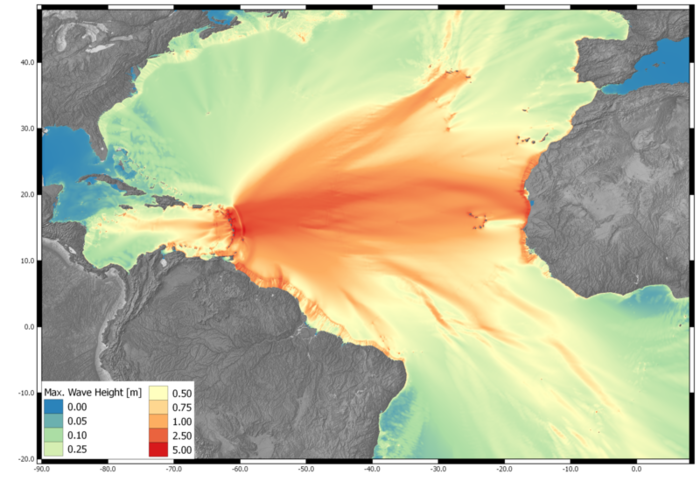
The model uses probabilistic methodologies to determine tsunami-earthquake return periods, but also detailed deterministic methods to analyse single event variabilities. The model includes the assessment of source variability, e.g. by the definition of source geometries and parameters in conjunction with numerical wave propagation and inundation. Which is then compared to local exposure and vulnerability data for loss quantification. Almost all model elements have been optimised for the highly parallelized application on graphical processing units to perform a fast calculation.
First studies have been taken out in the Tasman Sea, the Caribbean and parts of the Pacific.