
Impact of recent and future drought events on river discharge and fluvial transport sector for the Rhine River
Project Description
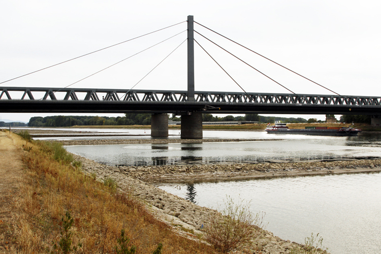
The Rhine River is Germanys most important inland waterway for transporting heavy goods and raw materials from and to the resident companies, with about 80% of the total market share for river transportation. Thus, restrictions on the navigability of the Rhine significantly impact the supply chains for the whole region, including several federal states. Interruptions in transport are mainly caused by high or low water levels in the Rhine River and its tributaries. For the former, extreme water levels are strongly influenced by widespread, intense precipitation in the catchment area, while for the latter, a lack of precipitation results in severe drought conditions and low soil moisture levels across the basin. In this project, we will focus on the impact of long-lasting drought events (e.g., 2018, 2022) on the river discharge and, thus, the navigability of the Rhine River in a changing climate using a high-resolution coupled atmosphere-hydrology modelling approach. We will exploit the LAERTES-EU dataset, comprising ~12.000 years of regional climate model data over Europe, to assess not yet observed drought periods (so-called black swan events) and their impact on river discharges. Furthermore, pseudo-global warming (PGW) experiments with the coupled atmosphere-hydrology model WRF/WRF-hydro based on present-day drought cases will provide information about possible changes in return levels of such events in a warmer climate. The obtained information is exchanged with stakeholders to exploit the implications for river transportation and business interruption for resident companies along the Rhine River.
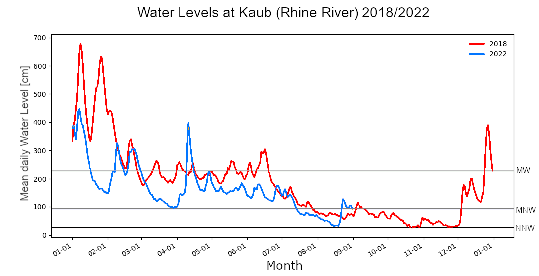
Figure Caption: Mean daily water level [cm] at Kaub (Rhine River) for the drought years 2018 (red) and 2022 (until September; blue). NNW: lowest recorded water level, MNW: mean lowest water level (2006–2015), MW: mean water level (2006–2015).
Simulating streamflow values with WRF-Hydro by using not yet observed meteorological droughts
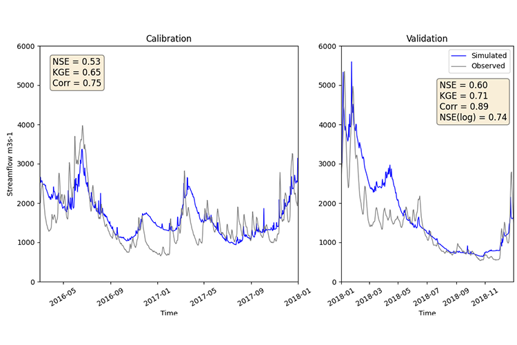
New options for calibrating the numerical hydrological model WRF-Hydro for recording extremely low discharges in the Rhine River.
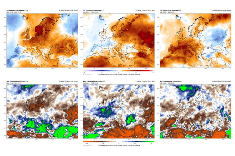
High temperatures and absence of precipitation contributes to more recurrent drought events in the Rhine River Basin.