Project Description
Motivation:
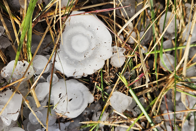
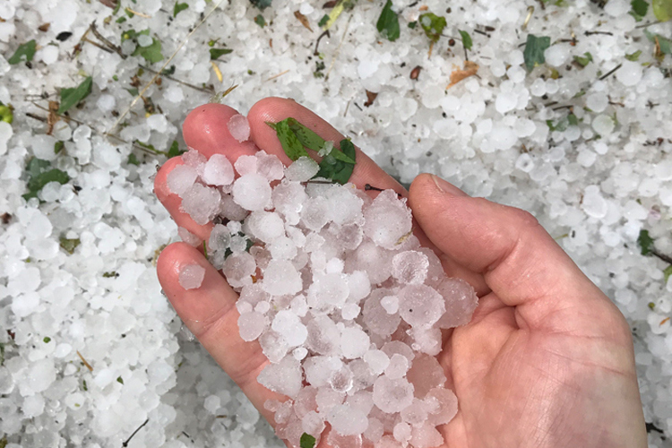
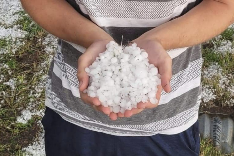
Hailstorms constitute one of the major atmospheric risks in many parts of the world. While they are most frequently observed and studied in Central North America, hail hazard is less well-known in many other regions. Still, insured hail damage can reach hundreds of M€ in a single event also in these places. Compared to other atmospheric hazards, hailstorms concern only small areas. In combination with the low frequency at a single location, this means that little is known about the relative importance of the local hazard and risk, and about the atmospheric conditions favourable to strong convective storms producing hail. Due to the high but uncertain damage potential, there is considerable interest in this topic from the insurance industry. Knowledge on hail frequency and severity helps actors on the insurance market with more solid estimates of hail-linked monetary risks and to better estimate required premiums.
Project activities:
In this project, stochastic models for the frequency, extent and severity of hail events have been developed for Europe, Australia, South Africa, and South America thus far. Research at KIT is focusing on the hazard component of the risk model. For this, satellite data provided in collaboration with NASA Langley is used to identify major convective storms associated with hail. For details see publications below. The method leads to unique, spatially homogeneous event data set covering entire continents for time periods of more than a decade. Stochastic modelling of the frequency, length, width, and severity of hail events then allows to generate a large event set for hailstorms expected to occur in several thousand years. This event set can in turn be combined with insurance portfolios in order to estimate loss events for certain return periods.
Other aims of the project are to improve the understanding the prevailing atmospheric conditions and processes during hail events, especially for large impact "tail" events associated with supercells. The impact of climate change on hail formation is another highly-relevant research focus.
Partners:
Willis Research Network:
Willis Towers Watson is a leading global advisory, broking and solutions company. Through the Willis Research Network (WRN), founded in 2006, it partners with a network of currently 50 public research institutions worldwide. WRN operates through the organization of common workshops with participation of their clients, the financing of staff hosted at the partner institutions as Willis research fellows, and regular individual work meetings between WRN staff and the partners. Dr. Heinz Jürgen Punge was the Willis research fellow for hail research at KIT between 2012 and 2022. Since then, the position was taken over by Dr. Jannick Fischer.
NASA Langley Research Center:
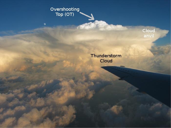
NASA Langley is a major public research institution in the US. In the context of this project, algorithms that allow the accurate identification of convective storms from satellite data have been developed.
Project duration:
The project started in June 2012 for an unlimited period with mutual annual cancellation options.
Publikationen:
Allen, J. T., Giammanco, I. M., Kumjian, M. R., Punge, H. J., Zhang, Q., Groenemeijer, P., Kunz, M., Ortega, K. (2020): Understanding hail in the earth system, Rev. Geophys., 58 (1), e2019RG000665, doi:10.1029/2019RG000665.
Bedka, K. M., Allen, J. T., Punge, H. J., Kunz, M., Simanovic, D., 2018: A Long-Term Overshooting Convective Cloud Top Detection Database Over Australia Derived From MTSAT Japanese Advanced Meteorological Imager Observations. J. Appl. Meteorl. Climatol., doi:10.1175/JAMC-D-17-0056.1.
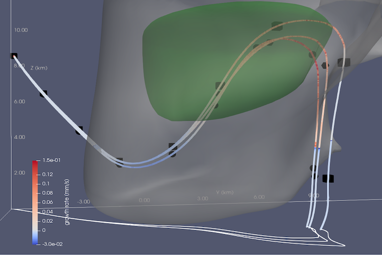
Fischer, J., Michael Kunz, Kelly Lombardo, Matthew Kumjian, 2024: Hail Trajectories in a Wide Spectrum of Supercell-like Updrafts. J. Atmos. Sci., 82, 1403–1422, https://doi.org/10.1175/JAS-D-24-0222
Fischer, J., Kelly Lombardo, Matthew Kumjian, Yuzhu Lin, 2026: Simulated Hail Trajectories under Climate Change: Disentangling the Roles of Moisture, Melting Level, and Updraft Kinematics, npj Clim. Atm. Sci., submitted.
Kunz, M., Blahak, U., Handwerker, J., Schmidberger, M., Punge, H. J., Mohr, S., Fluck, E., Bedka, K. M. (2018): The severe hailstorm in SW Germany on 28 July 2013: Characteristics, impacts, and meteorological conditions. Q. J. R. Meteor. Soc.,144, 231-250, doi:10.1002/qj.3197.
Punge, H.J., K. Bedka, M. Kunz, and A. Werner (2014): A new physically based stochastic event catalog for hail in Europe. Nat. Hazards, doi:10.1007/s11069-014-1161-0.
Punge H. J., M. Kunz (2016): Hail observations and hailstorm characteristics in Europe: A review. Atmos. Res. 176, 159–184, doi:10.1016/j.atmosres.2016.02.012.
Punge, H.J., Bedka, K.M., Kunz, M., Reinbold, A. (2017): Hail frequency estimation across Europe based on a combination of overshooting top detections and the ERA-INTERIM reanalysis, Atmos. Re., 198,34–43, doi:10.1016/j.atmosres.2017.07.025.
Punge, H. J., Bedka, K. M., Kunz, M., Bang, S. D., Itterly, K. F. (2023): Characteristics of hail hazard in South Africa based on satellite detection of convective storms, Nat. Hazards Earth Syst. Sci., 23, 1549–1576, doi:10.5194/nhess-23-1549-2023.
Wilhelm, J., Mohr, S., Punge, H. J., Mühr, B., Schmidberger, M., Daniell, J. E., Bedka, K. M., Kunz, M. (2021): Severe thunderstorms with large hail across Germany in June 2019. Weather, 76, 228–237, doi:10.1002/wea.3886.
Thousands of hail trajectories in idealized supercell ensembles were simulated and show the roles of changing temperature, moisture, and updrafts.
3 things to know about climate change and hail risk
WTW continues its long-standing partnership with CEDIM and NASA to advance the understanding and modeling of hail risks. Building on more than a decade of collaboration, this new phase will focus on using state-of-the-art data sets and research to address the challenges posed by hailstorms, with an emphasis on the impact of climate change.
Every year, extreme weather events cause millions of euros worth of damage. What role does climate change play? How can we prevent damage?
Report in the Klimanavigator (in German)

In July 2023, northern Italy witnessed two unprecedented European hailstone records. These occurrences prompt
questions about the influence of climate change on such extreme events and the potential for increased severity in the future.
link (see Section 2.2)
Valuable data for the insurance industry: Satellite data is used to estimate the spatial distribution and return periods of hail.
The power of geostationary satellites for improved hail risk assessment
Based on satellite data, the spatial distribution and thus the risk of hailstorms in South America is estimated.
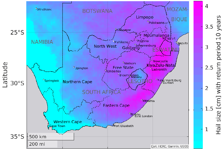
Within the framework of the "Willis Hail Hazard Assessment" project in cooperation with the Willis Research Network, the hail hazard in South Africa has been estimated.
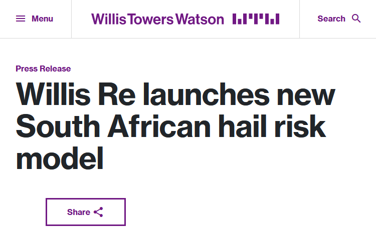
Willis Re has launched a new Hail Catastrophe Risk Model which quantifies the risk from damaging hail events across South Africa. Developed in collaboration with Willis Research Network partners at CEDIM/IMK-TRO (siehe oben) and NASA’s Langley Research Centre, the model delivers a robust view of hail risk for the (re)insurance market.
Short Report, Last update: 25. Juni 2019