
Climate Indicators for Rural Areas – A Guide for Municipal Climate Adaptation?
The interdisciplinary LandWandel project links regional climate change with its (economic) impacts on rural areas and municipalities. This is done by developing new climate indicators and, interdependently, by evaluating efficient climate adaptation measures that reflect the municipal decision-making process. The two KIT institutes involved, Institute of Meteorology and Climate Research Troposphere Research (IMKTRO) / South German Climate Office and Institute for Industrial Production (IIP), can draw on the practical experience of Freudenstadt’s local public utility company, as well as on the expertise of the city of Freudenstadt and the German Association of Local Public Utilities (VKU) in Baden-Württemberg.
In the project’s first year, structured surveys and expert interviews were conducted to collect regional experiences with weather events and their effects on professional activities. In addition, the city of Freudenstadt’s implemented and planned climate adaptation measures were systematically recorded for the fields of energy, water, and mobility. Based on the collected data, interdependency structures were created to show the relationships between meteorological parameters, the actors’ experiences, and adaptation measures for protection against or adaptation to climate impacts. The created interdependency structures served as a basis for deriving climate parameters such as heat or cool nights, which describe the summer heat experience.
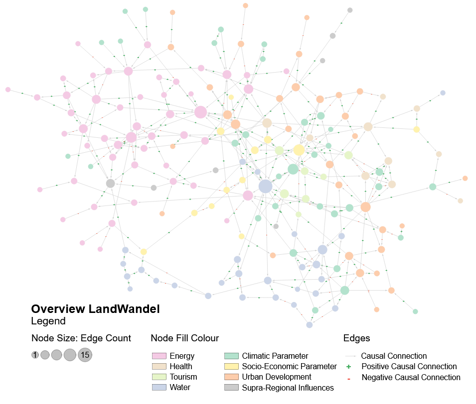
In the second year of the project, the work of the IIP focuses on the analysis of socio-economic and techno-economic system interrelations. To this end, a graph is being created to depict the complex network structure, which refines the previously created structures of effects and adds further effect factors based on literature research.
The categorization of the graph’s nodes (see Figure 1) is also based on the fields of action of the German Climate Adaptation Strategy. Additional categories include “socio-economics parameters”, “climate parameters”, and “supra-regional factors”. The interdependencies between the nodes are represented by directed and evaluated edges. The network validation is made possible by feedback with other project partners and stakeholders in the city of Freudenstadt. The network allows a comprehensive understanding of the system interrelations and identifies the factors on vulnerable nodes that go beyond climatic influences. Therefore, the graph helps to identify potential climate adaptation measures, analyze their impact, and enhance existing measures to ensure efficient municipal climate adaptation.
To enable long-term use and knowledge transfer of the project results for municipal decision-makers, a digitally available catalog called “AnLand” will be developed in the project. This will enable a particularly target-group-specific preparation of the scientific results.
Associated institute at KIT: Institute for Industrial Production (IIP)
Authors: Sonja Rosenberg, Ines Hofmann, Frank Schultmann