
Disaster & risk data in a new look
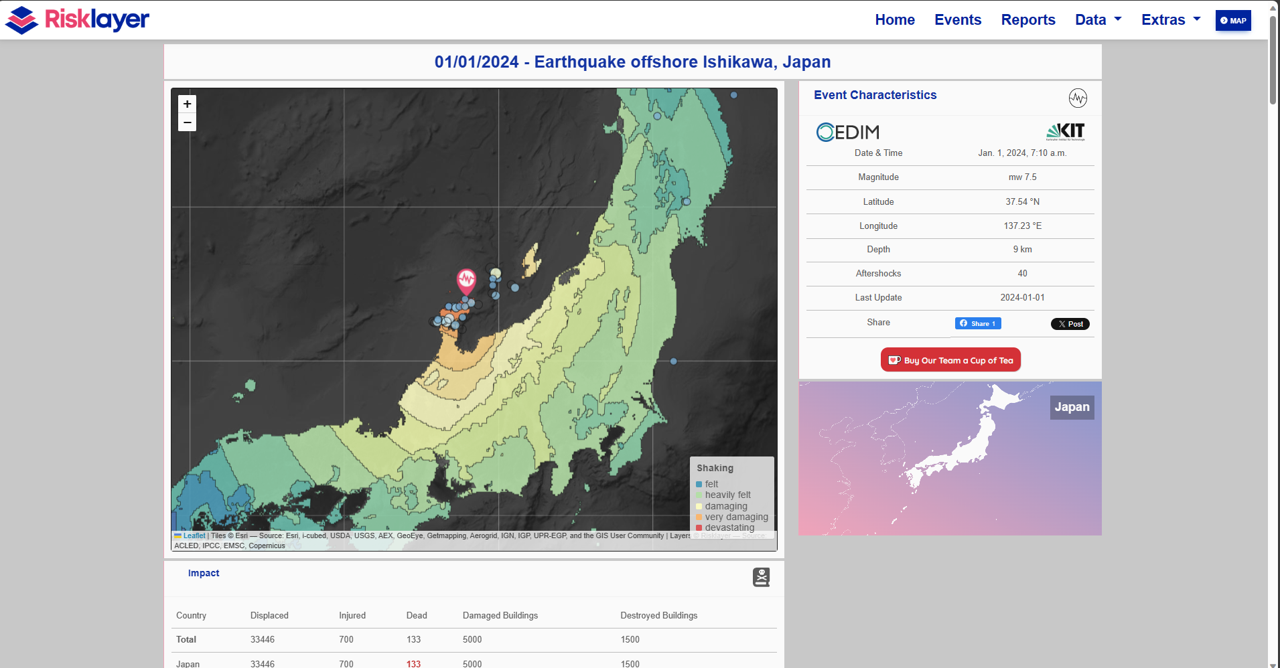
Since we needed a platform for the results of our crowdsourcing activities to track infection and hospitalisation figures at the start of the corona pandemic, the CEDIM/Risklayer-Explorer has come a long way. Originally created as a corona dashboard and manual reporting of ongoing earthquakes, our system has continued to grow. The focus on pandemic data has disappeared since spring 2022, replaced by impact maps for earthquakes and tropical cyclones – updated daily and often within minutes of an earthquake, for example.
The earthquake database now goes back to 2020 and is regularly updated with historical catastrophes. We also include loss and casualty figures for major catastrophes, where available. In addition to impact maps (e.g. the intensity of earthquakes or wind speeds of tropical cyclones), we also provide near-real-time estimates of how many people could be affected and to what extent, or information on the critical infrastructure affected, such as power stations.
In addition to event data, we also provide country-specific risk and climate data in collaboration with the CEDIM spin-off Risklayer and related projects. This allows interested parties to access current events or individual country risk profiles either via a contextual search or via links. The latter are displayed, for example, using specially developed indices (e.g. heat risk). Future changes in certain climate parameters are also visualised, taking climate change into account with the help of various climate simulations. For example, by the end of the century, heat stress in Germany will have reached the level of heat stress in Italy today.
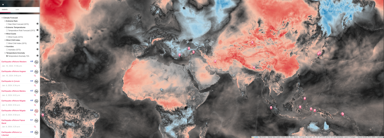
In addition to current data on earthquakes or tropical cyclones, other publicly available data sources are also aggregated to communicate current risk situations relating to floods, forest fires, droughts or volcanic eruptions. You can also find up-to-date maps of extreme temperature, precipitation or wind events, as well as average earthquake risk.
We are continually working to expand CEDIM/Risklayer Explorer (https://www.risklayer-explorer.com) to include additional risks.
Associated institute at KIT: Geophysical Institute (GPI)
Author: Andreas Schäfer (Jan. 2024)